
MODERATO Marco
- CASES, Universitat Pompeu Fabra, Barcelon, Spain
- Antiquity, Asia, Ceramics, Computational archaeology, Environmental archaeology, Landscape archaeology, Medieval, Post-Classic, Spatial analysis
Recommendations: 0
Review: 1
Review: 1
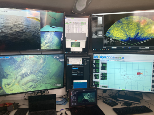
Advancing data quality of marine archaeological documentation using underwater robotics: from simulation environments to real-world scenarios
Beyond Deep Blue: Underwater robotics, simulations and archaeology
Recommended by Daniel Carvalho based on reviews by Marco Moderato and 1 anonymous reviewerDiamanti et al. (2024) is a significant contribution to the field of underwater robotics and their use in archaeology, with an innovative approach to some major problems in the deployment of said technologies. It identifies issues when it comes to approaching Underwater Cultural Heritage (UCH) sites and does so through an interest in the combination of data, maneuverability, and the interpretation provided by the instruments that archaeologists operate. The article's motives are clear: it is not enough to find the means to reach these sites, but rather is fundamental to take a step forward in methodology and how we can safeguard certain aspects of data recovery with robust mission planning.
To this end, the article does not fail to highlight previous contributions, in an intertwined web of references that demonstrate the marked evolution of the use of Unmanned Underwater Vehicles (UUVs), Remote Operated Vehicles (ROVs), Autonomous Underwater Vehicles (AUVs) and Autonomous Surface Vehicles (ASVs), which are growing exponentially in use (see Kapetanović et al. 2020). It should be emphasized that the notion of ‘aquatic environment’ used here is quite broad and is not limited to oceanic or maritime environments, which allows for a larger perspective on distinct technologies that proliferate in underwater archaeology. There is also a relevant discussion on the typologies of sensors and how these autonomous vehicles obtain their data, where are debated Inertial Measurement Units (IMU) and LiDAR systems.
Thus, the authors of this article propose the creation of a model that acquires data through simulations, which allows for a better understanding of what a real mission presupposes in the field. Their tripartite method - pre-mission planning; mission plan and post-mission plan - offers a performing algorithm that simplifies and provides reliability to all the parts of the intervention. The use of real cases to create simulation models allows for a substantial approximation to common practice in underwater environments. And yet, the article is at its most innovative status when it combines all the elements it sets out to explore. It could simply focus on the methodological or planning component, on obtaining data, or on theoretical problems. But it goes further, which makes this approach more complete and of interest to the archaeological community. By not taking any part as isolated, the problems and possible solutions arising from the course of the mission are carried over from one parameter to another, where details are worked upon and efficiency goals are set.
One of the most significant cases is the tuning of ocean optics in aquatic environments according to the idiosyncracies of real cases (Diamanti et al. 2024: 8), a complex endeavor but absolutely necessary in order to increase the informative potential of the simulation. The exploration of various data capture models is also welcome, for the purposes of comparison and adaptation on a case-by-case basis. The brief theoretical reflection offered at the end of the article dwells in all these points and problematizes the difference between terrestrial and aquatic archaeology. In fact, the distinction does not only exist in the technical component, as although it draws in theoretical elements from archaeology that is carried out on land (see Krieger 2012 for this matter), the problems and interpretations are shaped by different factors and therefore become unique (Diamanti et al 2024: 15). The future, according to the authors, lies in increasing the autonomy of these vehicles so that the human element does not have to make decisions in a systematic way. It is in that note, and in order for that path to become closer to reality, that we strongly recommend this article for publication, in conjunction with the comments of the reviewers. We hope that its integrated approach, which brings together methods, theories and reflections, can become a broader modus operandi within the field of underwater robotics applied to archaeology.
References:
Diamanti, E., Yip, M., Stahl, A. and Ødegård, Ø. (2024). Advancing data quality of marine archaeological documentation using underwater robotics: from simulation environments to real-world scenarios, Zenodo, 8305098, ver. 4 peer-reviewed and recommended by Peer Community in Archaeology. https://doi.org/10.5281/zenodo.8305098
Kapetanović, N., Vasilijević, A., Nađ, Đ., Zubčić, K., and Mišković, N. (2020). Marine Robots Mapping the Present and the Past: Unraveling the Secrets of the Deep. Remote Sensing, 12(23), 3902. MDPI AG. http://dx.doi.org/10.3390/rs12233902
Krieger, W. H. (2012). Theory, Locality, and Methodology in Archaeology: Just Add Water? HOPOS: The Journal of the International Society for the History of Philosophy of Science, 2(2), 243–257. https://doi.org/10.1086/666956